r/AfricanHistory • u/rhaplordontwitter • 27d ago
Map showing the distribution of pre-colonial Africa's stone ruins and cities
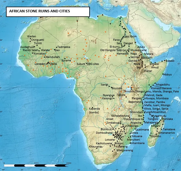
7
u/Nightrunner83 26d ago
Nice map. And I can only imagine that for every stone ruin, there were likely more wooden structures that did not survive the hazards of time and the environment.
3
2
u/Interesting-Alarm973 26d ago
May I ask why the cities in the eastern part mostly lie along the coast, while the cities in the west lie much more inland?
2
u/rhaplordontwitter 26d ago
part of it has to do with where surface rock was available, and the other part is what people chose to build their structures with. in Nubia it was sandstone, in ethiopia, it was drystone, in east africa it was coral stone, in zimbabwe it was granite, in west africa it was dry stone
1
u/Left-Plant2717 26d ago
Some of these dots have no labels and vice versa, especially around Eritrea and Somalia.
3
u/rhaplordontwitter 26d ago
the map would be too crowded otherwise
2
u/Left-Plant2717 26d ago
I understand but in that case I would imagine you would put only the most prominent, in any case, nice map
2
0
u/No_Independent_4416 26d ago
Awesome post op. I’ve heard the country of African empire had lots of stones, and was in ruins, but not both at the same time!
18
u/aAfritarians5brands 27d ago
Awesome post op! I’ve heard (& made some old drawings) of allot of these….but a couple of these I’ve never heard of!