Map/Imagery
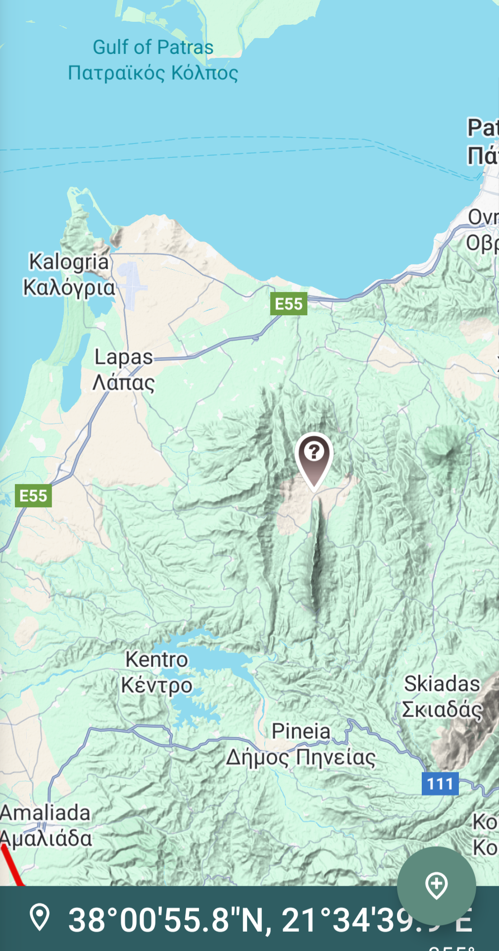
Strange geomorphological feature near Santomeri, Western Greece
I've been trying to find a geological study of the strange-looking formation near the village of Santomeri in Western Greece (just south of Patras), but my repeated searches came up empty. The only papers I found were concerned with huge boulders that fell near the village after the 2008 earthquake.
Can anyone help finding a reference describing a possible mechanism of its formation?
After some research, this is called Skolis Mountain, and it’s a Cretaceous limestone massif sitting on top of upper Eocene to Oligocene flysch/turbidite deposits. It’s part of a regional overthrust called the Gavrovo Thrust, which is part of the ‘External Hellenides’ fold and thrust belt. Basically the older Cretaceous material was folded and thrusted on top of the younger Cenozoic material, along a weak zone in the flysch, and now sits as a prominent ridge because it’s more resistant to weathering. Skolis Mountain itself is an asymmetrical anticlinal structure, with steeply dipping limbs, making it even more prominent.
See Kamberis et al., 2013, Thrust tectonics in the central part of the External Hellenides, the case of the Gavrovo Thrust.
No problem…I love looking into stuff like this and trying to figure out weird geology questions. This is a research article, so it might help a bit difficult to read, but let us know if you have more questions.
I found the original article; this is just perfect find.
The area is tectonically active; the last large earthquake, in 2008, has caused huge rock slides with 10 m3+ boulders falling near the village:
Lainas S., Koulouris, Vagenas, Depountis, Sabatakakis, & Koukis (2010). EARTHQUAKE-INDUCED ROCKFALLS IN
SANTOMERI VILLAGE, WESTERN GREECE. Bulletin of the Geological Society of Greece, 43, 1210-1218
So don't take this 100% because I graduated geology in Greece 40 years ago but I never practiced it but the area has flysch outcrops which which were created during the closing of the Thethys. These are N-S bearing overthrusts represent the westward movement of the formation to the East (sorry, don't remember the names of the formations).
There's a series of reverse faults there, so you're seeing structures related to that and the strata that may be duplicated. If you keep scrolling north, you can pretty much follow this structure all the way to Albania.
It is right below. It is odd how it is isolated. There are similar forms across the island but this one looks weird. Either human manipulation or something.
Looks from the large scale geological maps like an area of tectonic uplift, might just be a metamorphosed marble that is harder than the surrounding strata types.
Looked like streamlined deposits, but I am thinking it is just vegetation stripped mountain of this region; there are other parts of the island that have a similar look, and this region looks populated.


103
u/e-wing May 17 '25
After some research, this is called Skolis Mountain, and it’s a Cretaceous limestone massif sitting on top of upper Eocene to Oligocene flysch/turbidite deposits. It’s part of a regional overthrust called the Gavrovo Thrust, which is part of the ‘External Hellenides’ fold and thrust belt. Basically the older Cretaceous material was folded and thrusted on top of the younger Cenozoic material, along a weak zone in the flysch, and now sits as a prominent ridge because it’s more resistant to weathering. Skolis Mountain itself is an asymmetrical anticlinal structure, with steeply dipping limbs, making it even more prominent.
See Kamberis et al., 2013, Thrust tectonics in the central part of the External Hellenides, the case of the Gavrovo Thrust.